General information
Let’s have a look at a typical VFR flight in Europe today. The route may be interesting for some pilots who want to fly from the north to the French Riviera.
80 percent of my flights are IFR flights. This is simply because I want to have as much training as possible in the IFR system and because instrument flights tell you where to fly through and you rarely have to worry about any forbidden airspaces. As a disadvantage you get – at least in Europe – completely impossible routes prescribed, which often result in large detours. Not to mention the unfortunate slots, which turn an IFR flight in Europe into a time lottery again and again.
In contrast, a VFR flight – provided the weather conditions are right – has the advantage of more direct and therefore shorter flights. In contrast, you are completely responsible for good flight planning to avoid airspace violations.
If we now compare a flight from Bern LSZB in Switzerland to Cannes LFMD on the French Riviera, we have the following route options – with an air line of 204 NM (378 km).
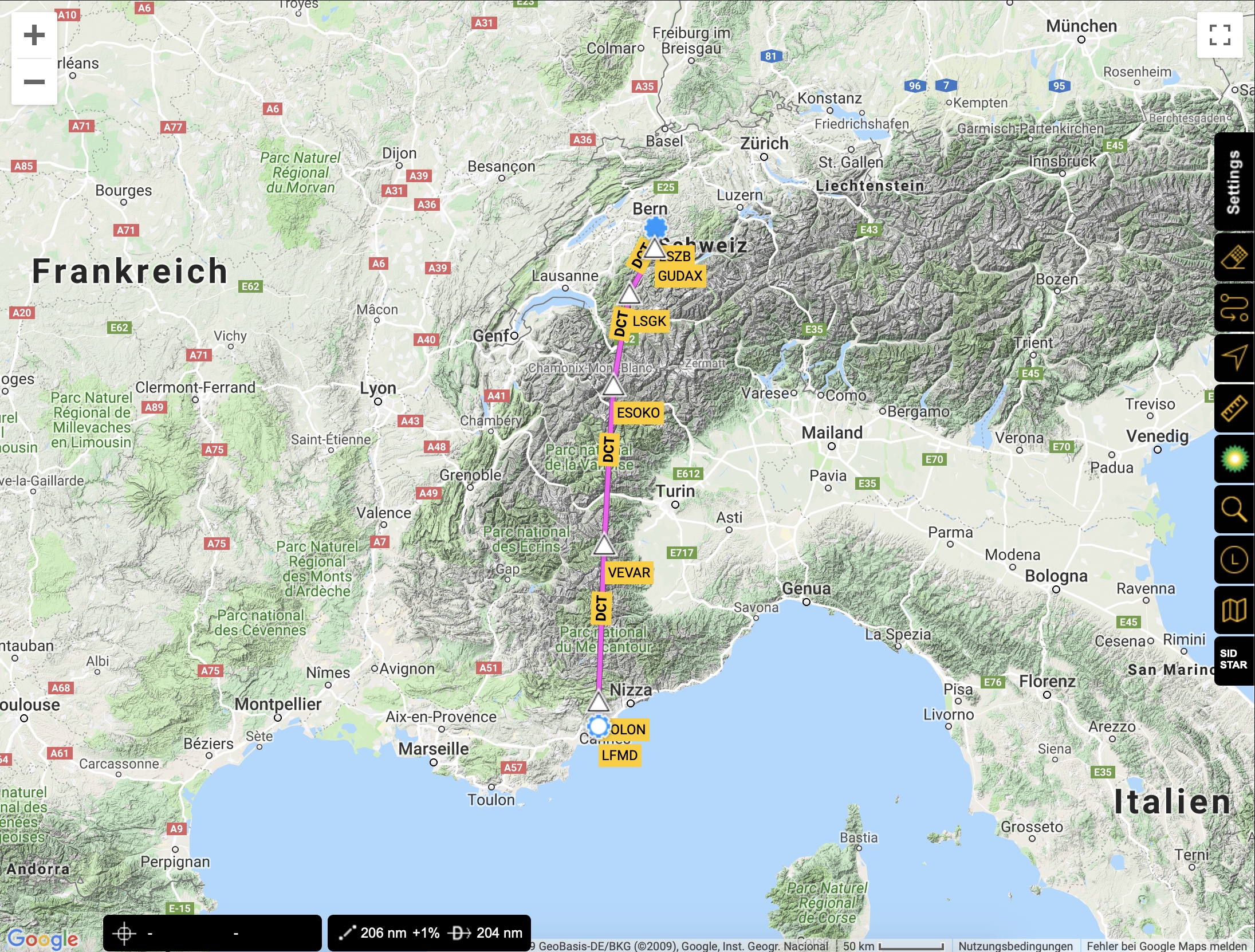
VFR (206 NM or 381 km): LSZB GUDAX LSGK MARTIGNY ESOKO VEVAR KOLON EW LFMD. This is an extremely direct route, which leads wonderfully past all restricted and danger zones.
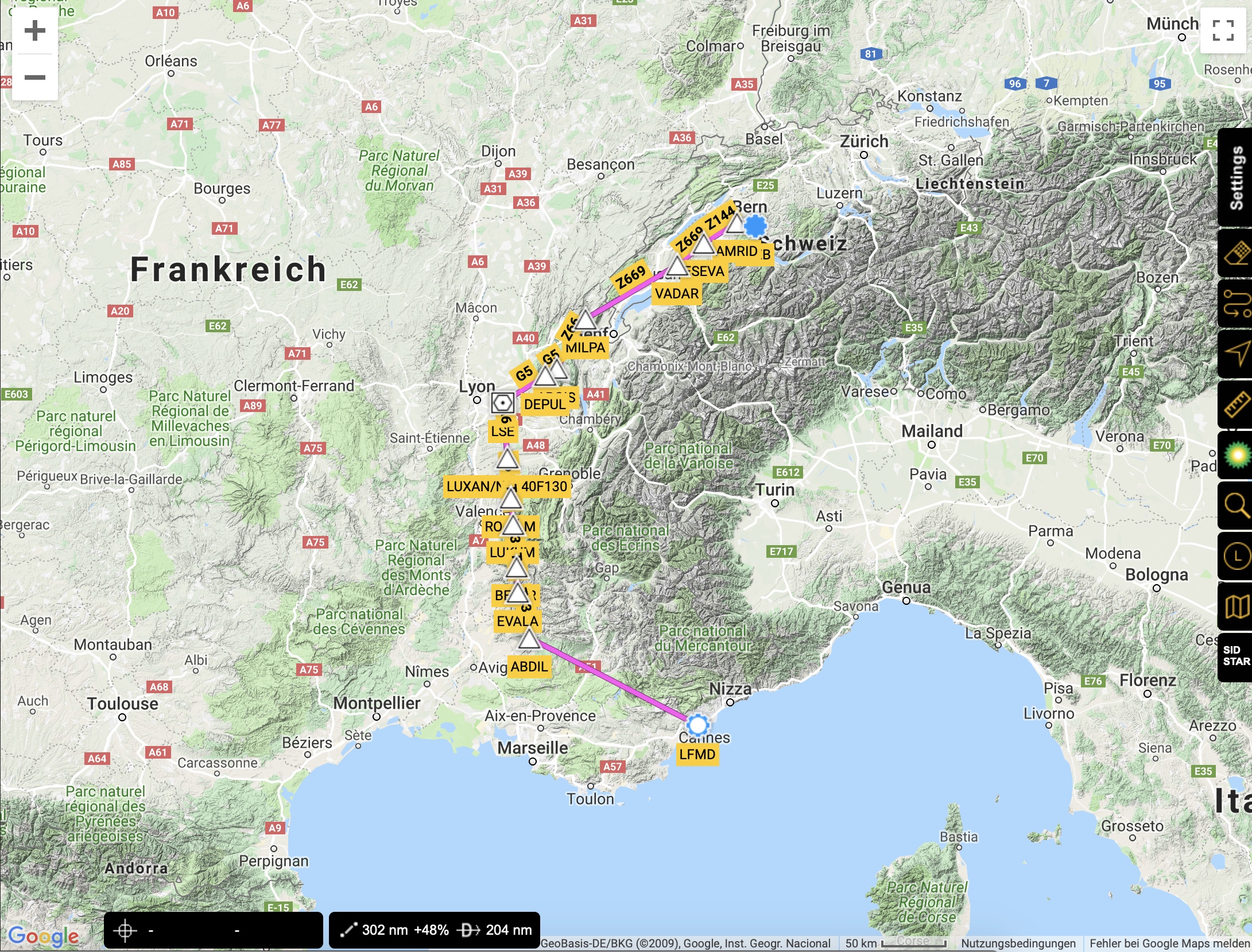
IFR (302 NM resp. 559 km): LSZB DCT AMRID Z144 ESEVA Z669 MILPA Z66 ARGIS G5 LSE A6 LUXAN/N0140F130 A6 ROMAM T43 ABDIL DCT LFMD
The flight distance of the IFR flight – and thus also the flight duration – is almost 50 percent longer. So this is a good argument if you try a VFR flight at Cannes if weather conditions permit.
Weather
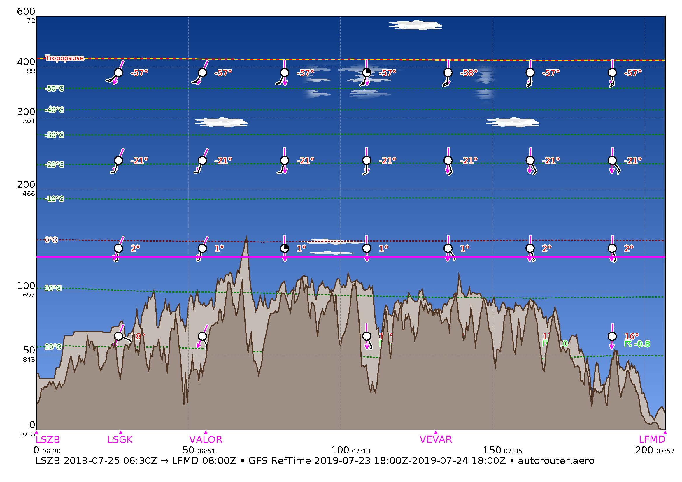
Let’s consider the flying weather on 25 July 2019. A gradually flattening high, stretching from Scandinavia to the Mediterranean, determines the weather in the Alpine region. The supply of hot air from the southwest to the Alpine region continues on its western flank. In the lowlands, the foothills of the Alps and the Alps it was cheerful, with a view over 8 km. In the early afternoon the formation of 1-2/8 spring clouds with a base of 12’000 ft/msl was to be expected along the main ridge of the Alps. Thunderstorms were expected in the afternoon at the most.
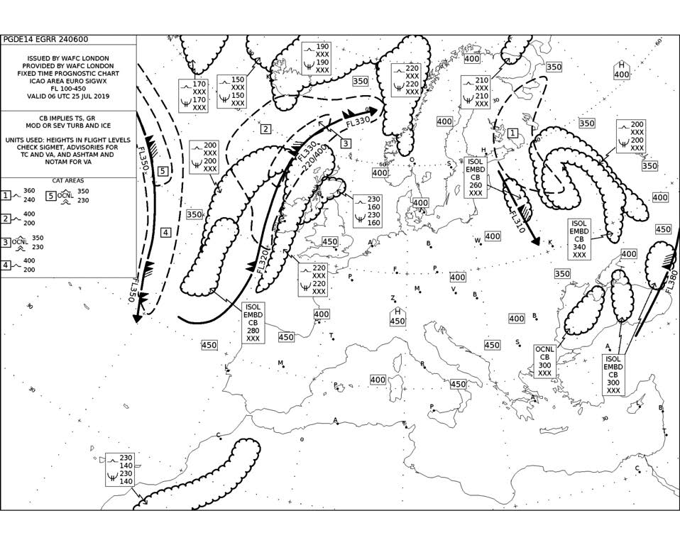
A look at GRAMET promised a day that Swiss pilots call „Grand Beau“. A VFR flight along the Franco-Italian border to the Mediterranean Sea was therefore no longer a problem.
Last preparations
As it should be one of the hottest days of the year with maximum temperatures of 38 deg C (100 deg F) in Switzerland, an early departure at 0830 LT (0630 UTC) was planned. Still in bed I did a last weather and NOTAM briefing at an early hour and gave up the VFR flight plan.
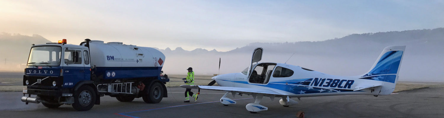
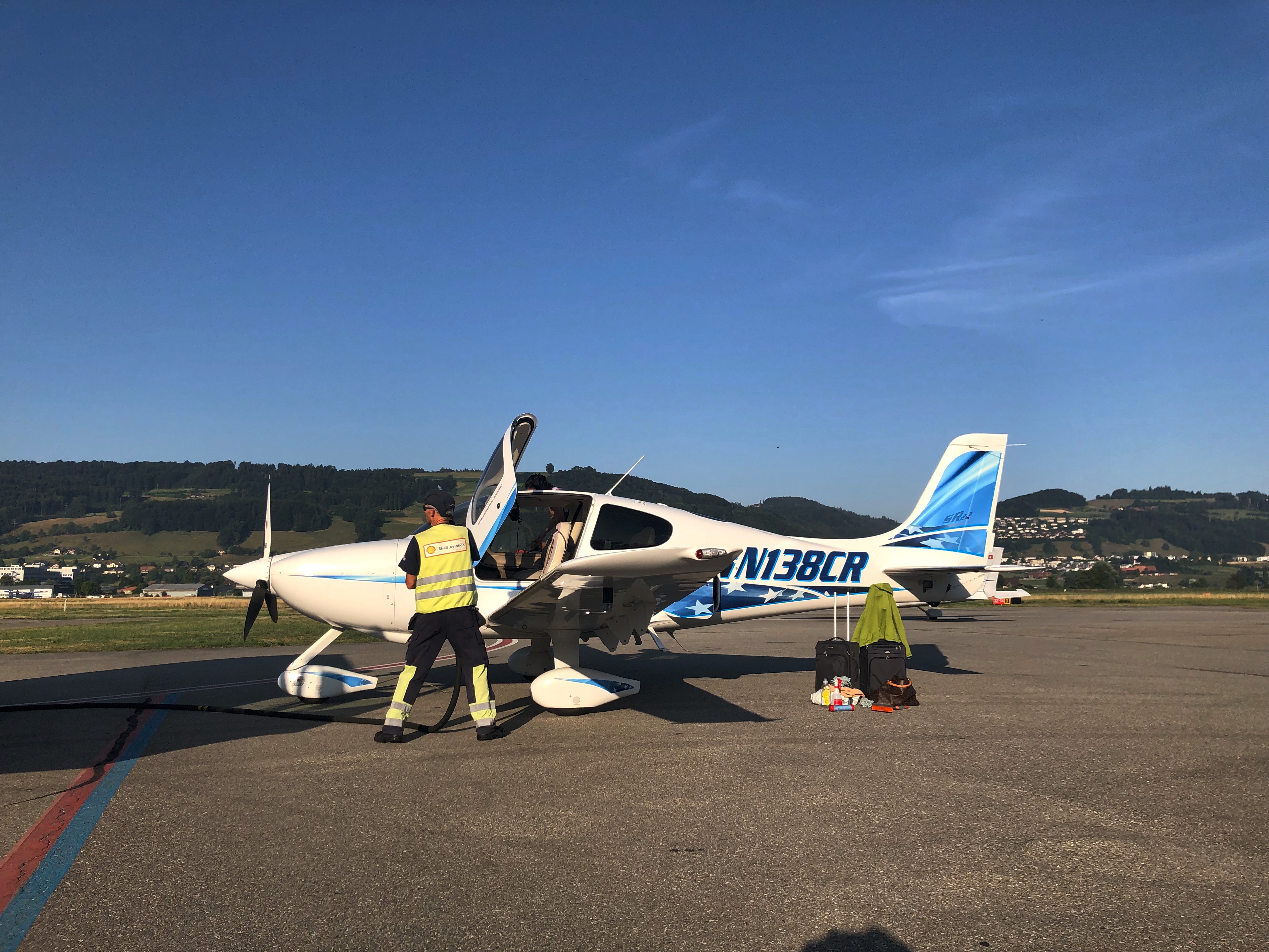
One hour before the departure, we were already on the airfield, where already large operation prevailed. We were not the only ones who wanted to fly early on this splendid day. Great heat does not only limit the performance of the airplane, but also that of the pilot.
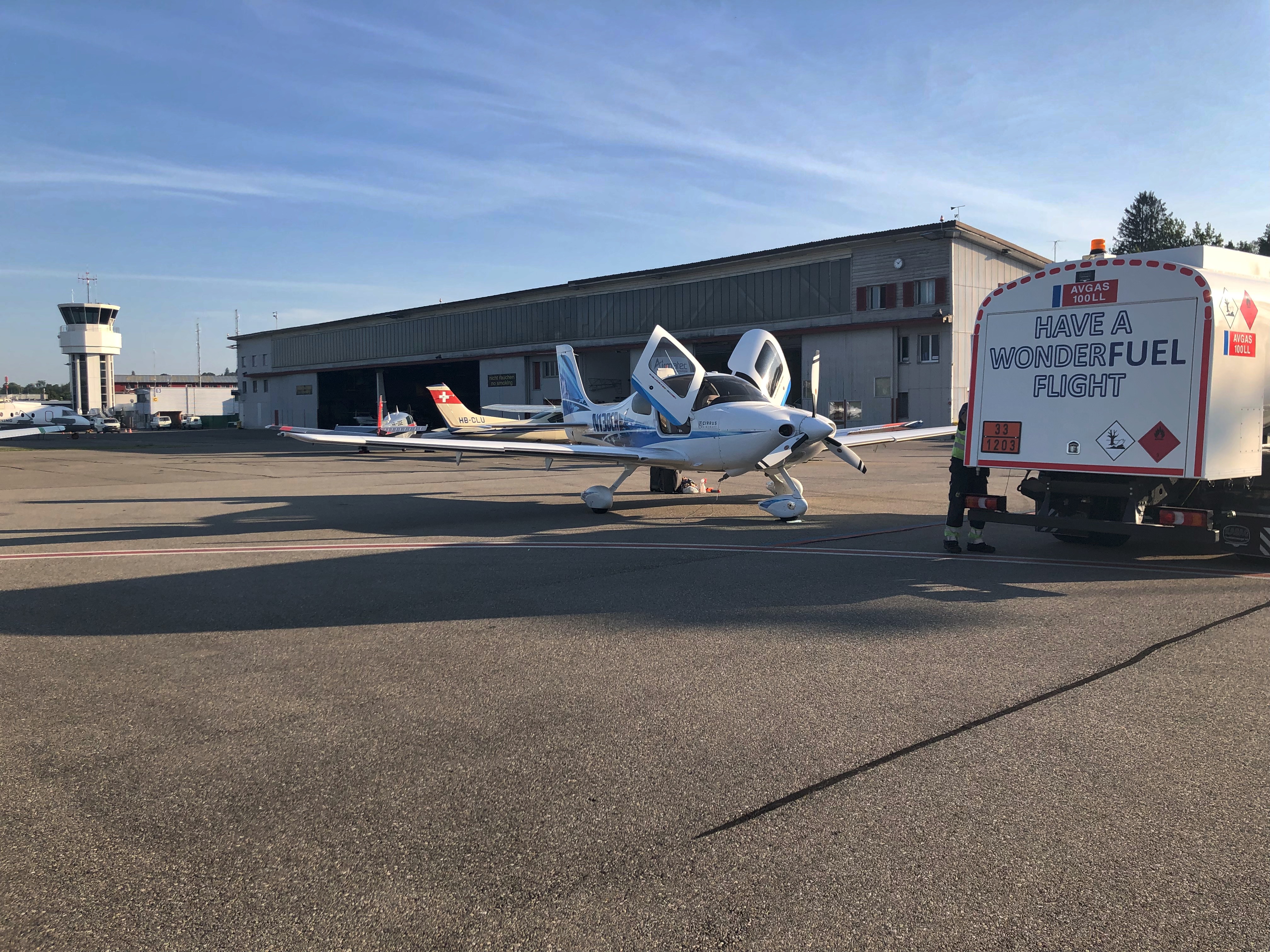
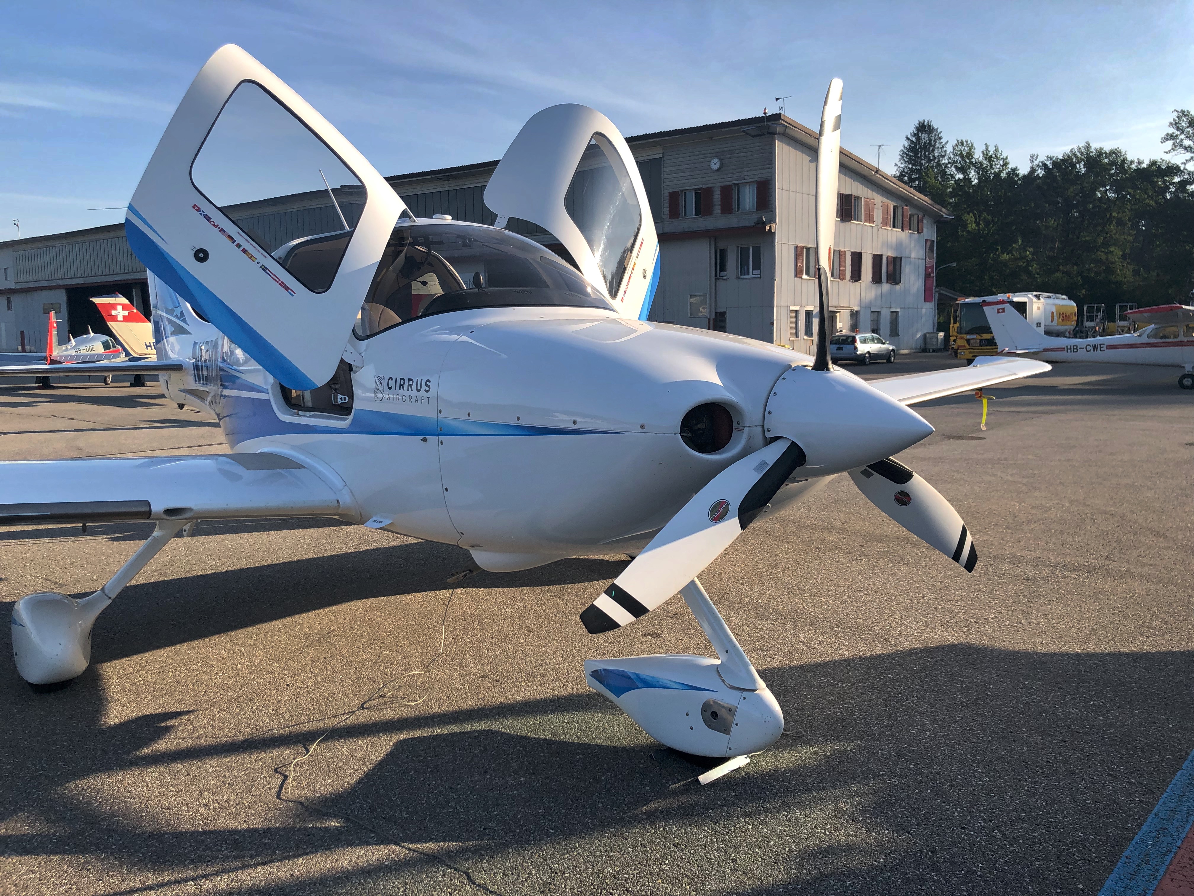
I had already ordered taking out the Cirrus of the hangar the day before. The plane was ready. We refuelled and provided a clear view with a clean windshield. Then we loaded and lashed the luggage and set up the cockpit. The current approach charts had to be loaded onto the MFD (Multi Function Display). Route maps and the GPS database were up to date. Also the Jeppesen database on both iPads was up to date. I always have two iPads with me since I fly paperless. So there are – besides the maps on the MFD – two more sets of maps available.
The flight
As usual, the big Conti started up without any problems, the avionic systems started up, the route was loaded from the iPad onto the two GTN 650 GPS/NAV/COMM/MFD touch screens by the WIFI-system of the Cirrus. The oil temperature that day was quickly up to the required 80 degF. The tower gave taxi permission to the Holding Point Alpha. There Check for Takeoff, Departure Briefing, a Backtrack to use the whole runway length and at 0820 LT we were in the air and left the CTR on the Outbound Route Sierra in direction of the IFR Waypoint GUDAX, which lies directly beside the excursion point Sierra.
I had to stop the climb for a short time in order not to climb to over 5’000 ft already in the CTR. Then we went further south and climbed to FL 130. At this altitude all alpine peaks on the route can be safely flown over, but of course oxygen has to be breathed.
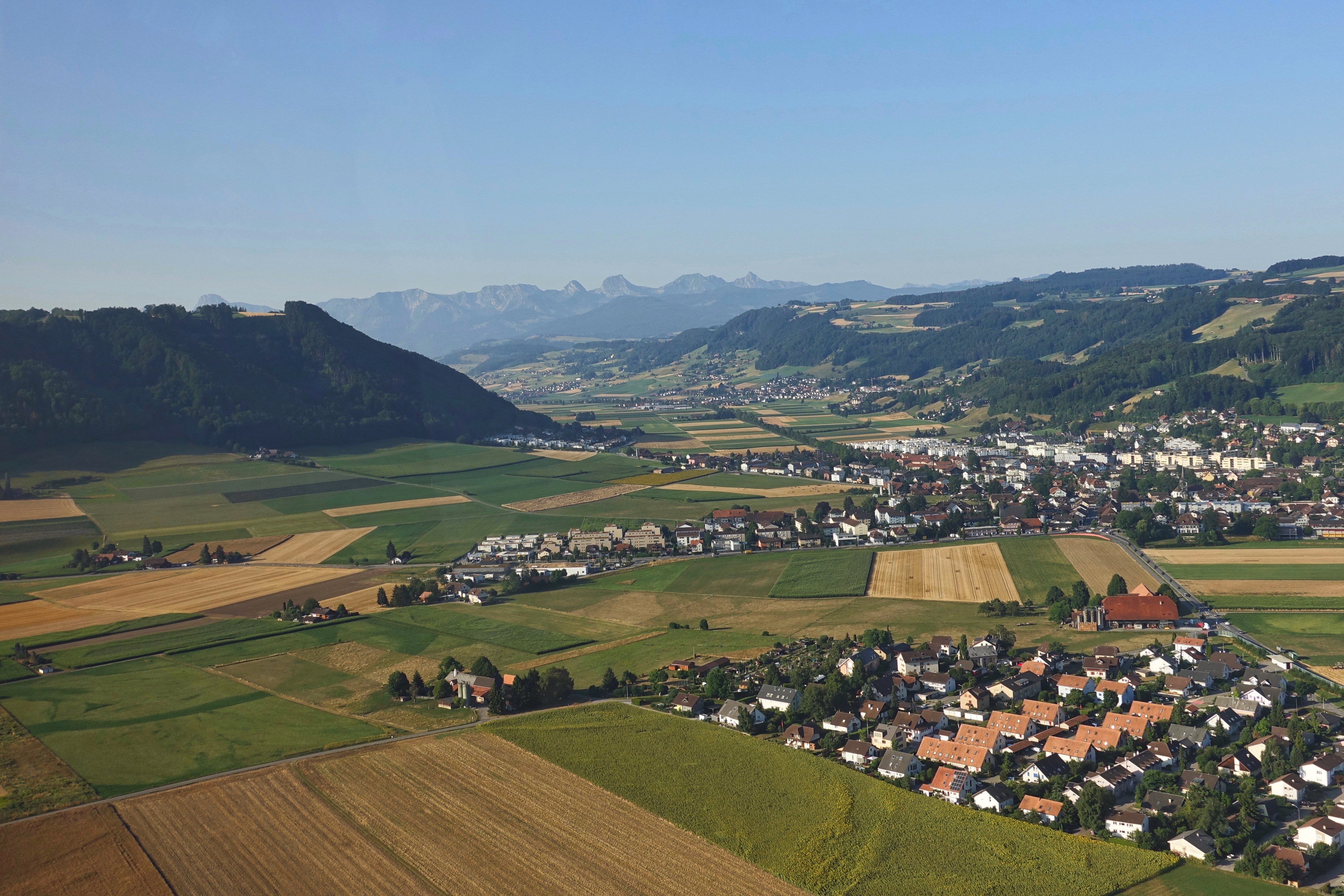
Leaving the airport direction south 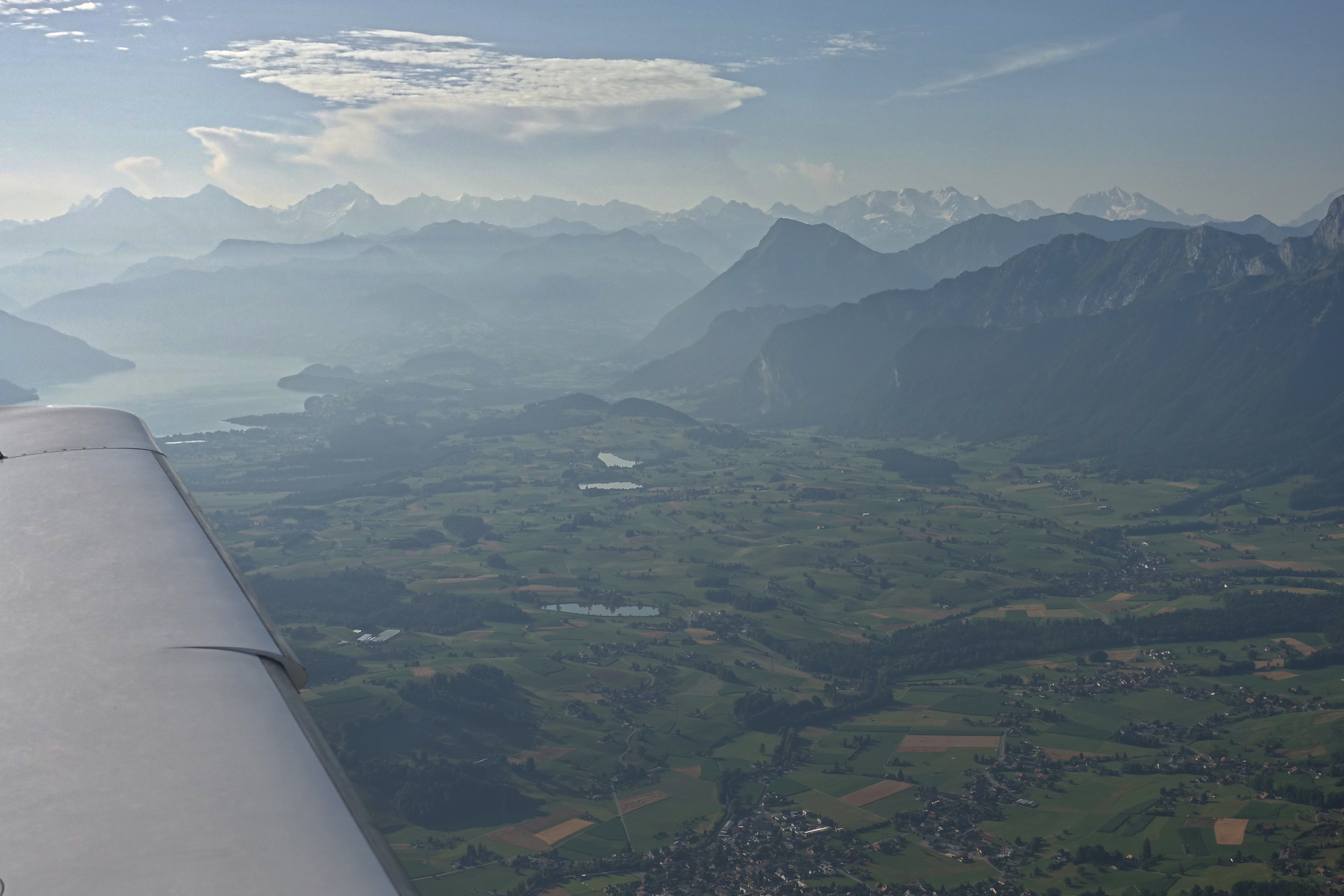
Bernese Alps and Lake Thun in the distance
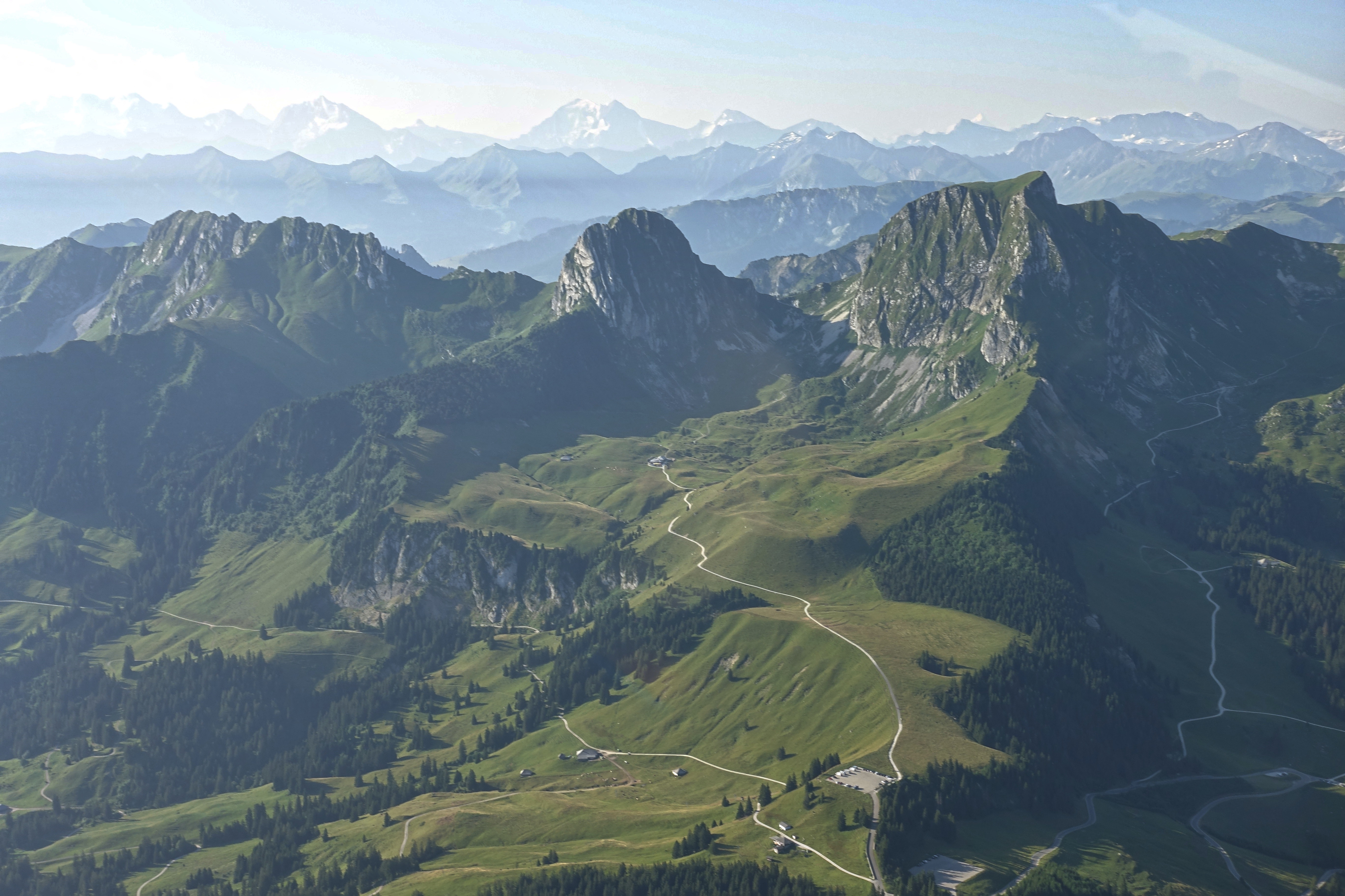
Gantrisch region south of Berne
On the route „George“ – the autopilot – flies most of the time. The tasks of the pilot focus on the radio and monitoring of systems and position.
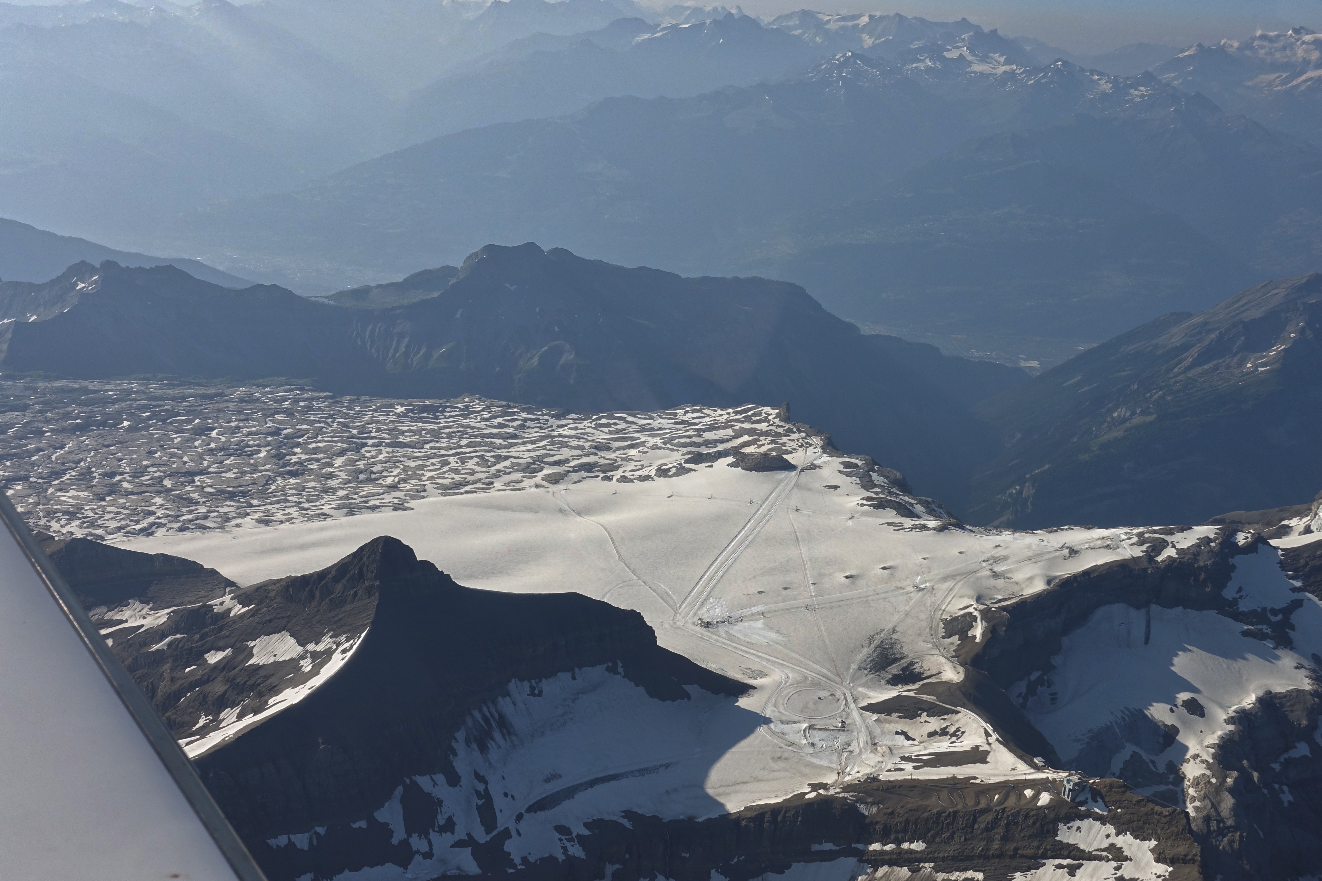
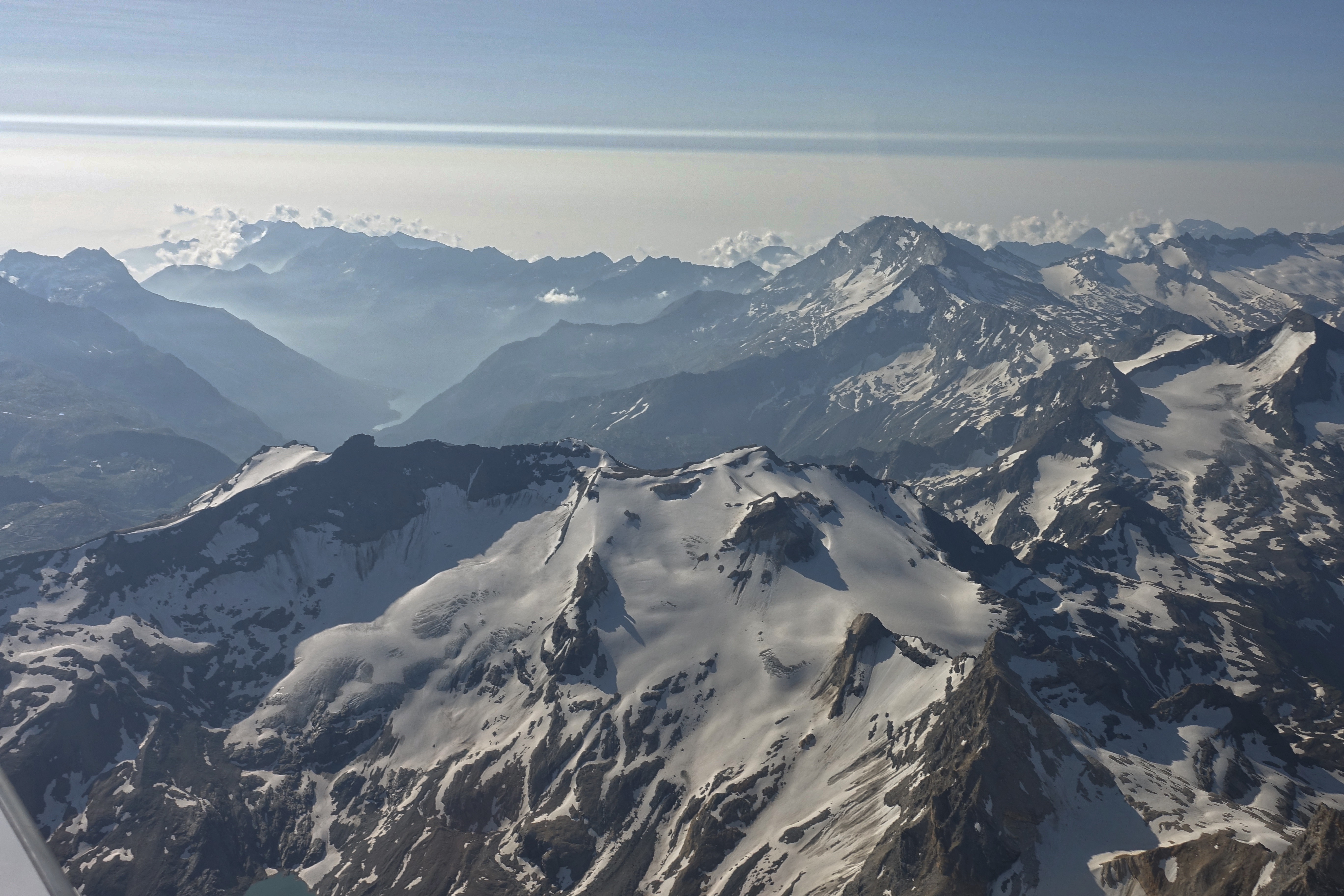
Today we had a haze layer up to FL 120. Only a few mountain peaks looked out of this layer and it was hardly possible to take clear photos. In times of climate change, it was impressive to see how the Alpine glaciers are melting. From the Diablerets glacier only a miserable remainder is left and it seems foreseeable when it will have disappeared completely. What was unthinkable a year ago is now a reality. Therefore, the author compensates his CO2 balance by planting trees.
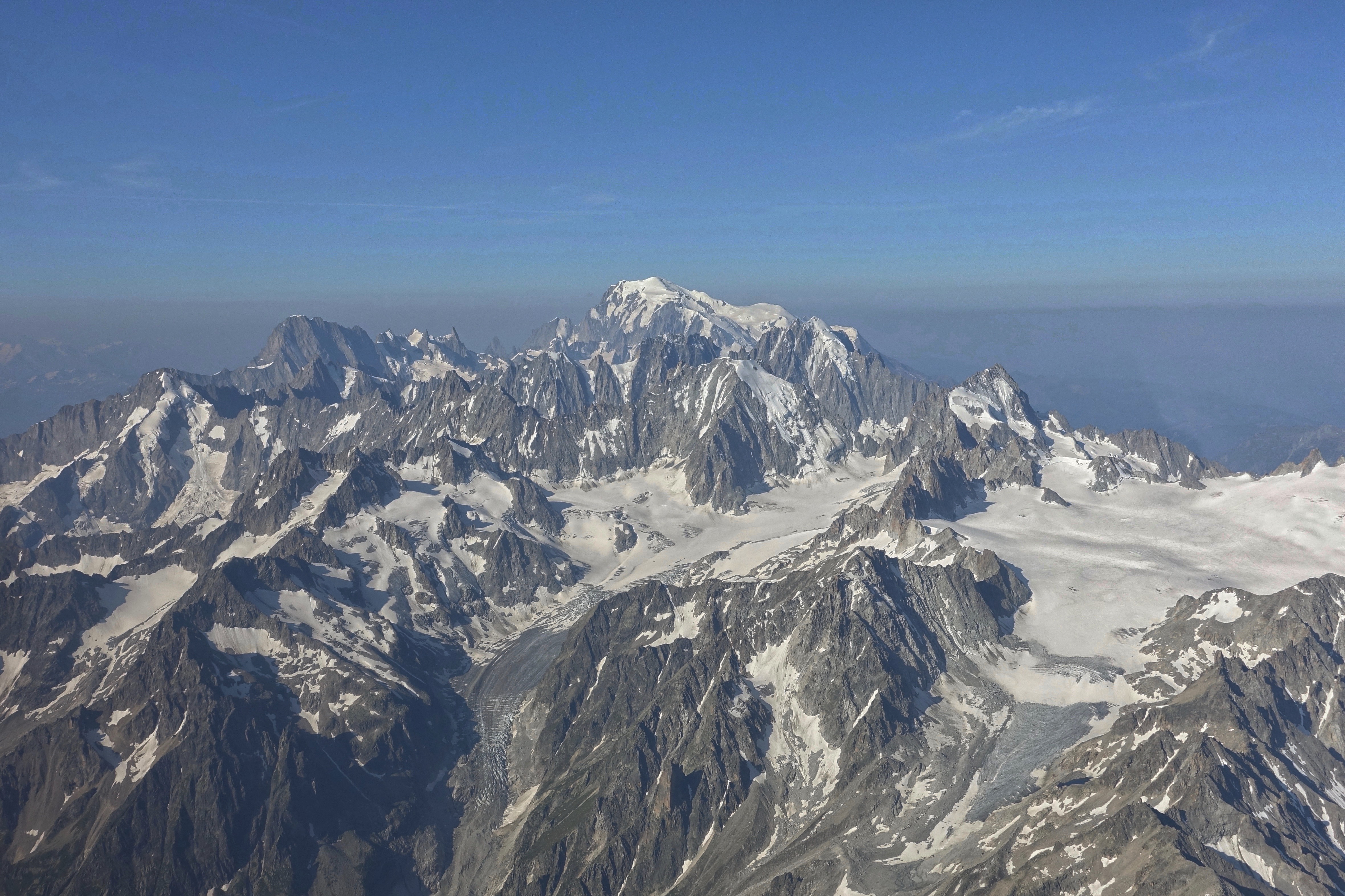 The Mont Blanc, in the heart of the Mont Blanc Massif, is the tallest peak in the Alps and the highest summit in Western Europe, hence its epithet the “Roof of Europe”. The mountain sits astride the Franco-Italian border, south of Chamonix and northwest of Courmayeur.
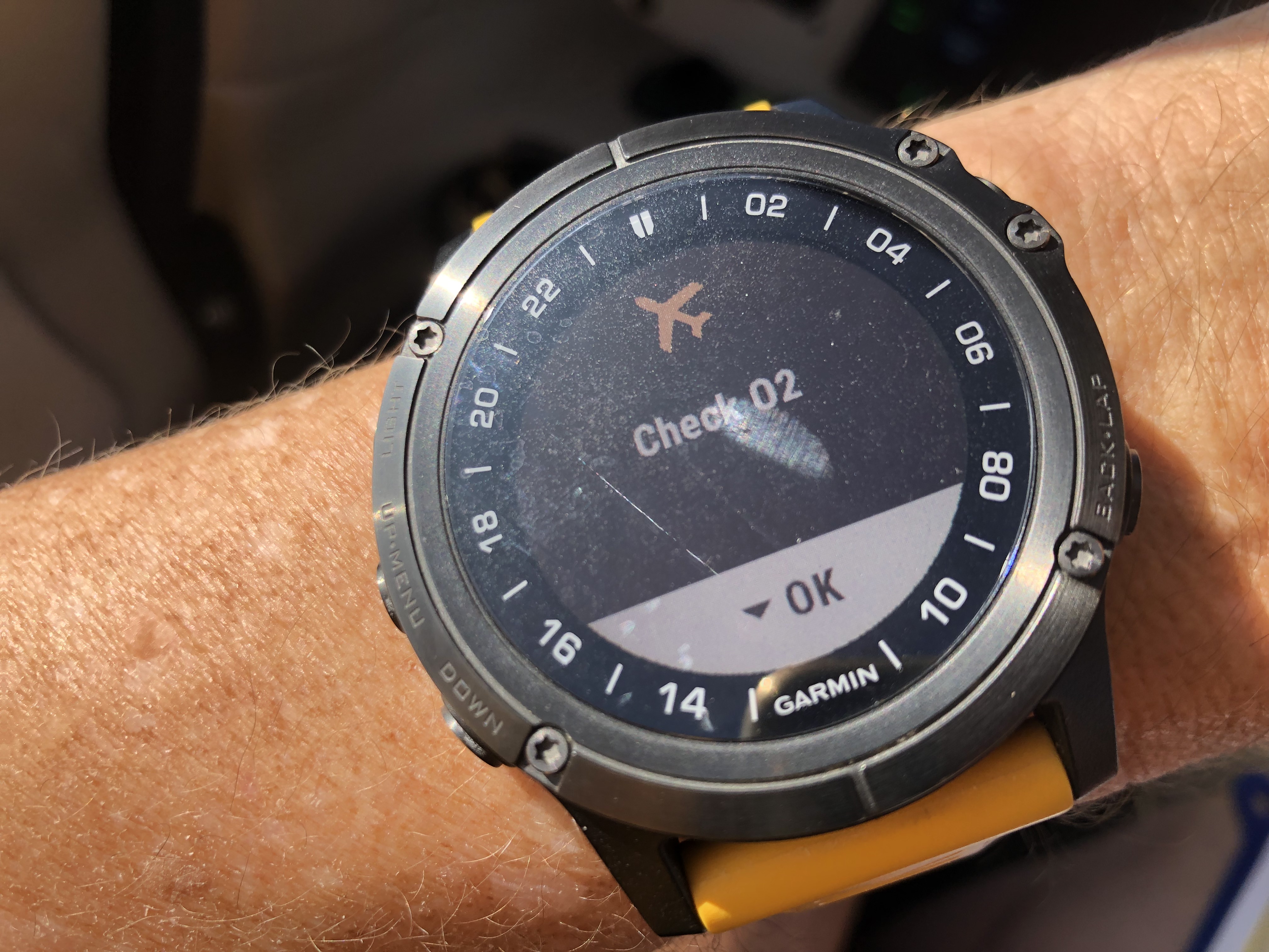
My Garmin Pilot watch constantly measures the oxygen saturation in the blood and reminds me when oxygen has to be breathed.
In the vicinity of the Saanen-Gstaad LSGK airfield, it is always important to look out due to parachute activity. After crossing the border at Col Ferret (Waypoint ESOKO) it is best to stay in touch with Geneva Information. Afterwards it is advisable to listen in on the frequencies of Marseille and Milano Information.
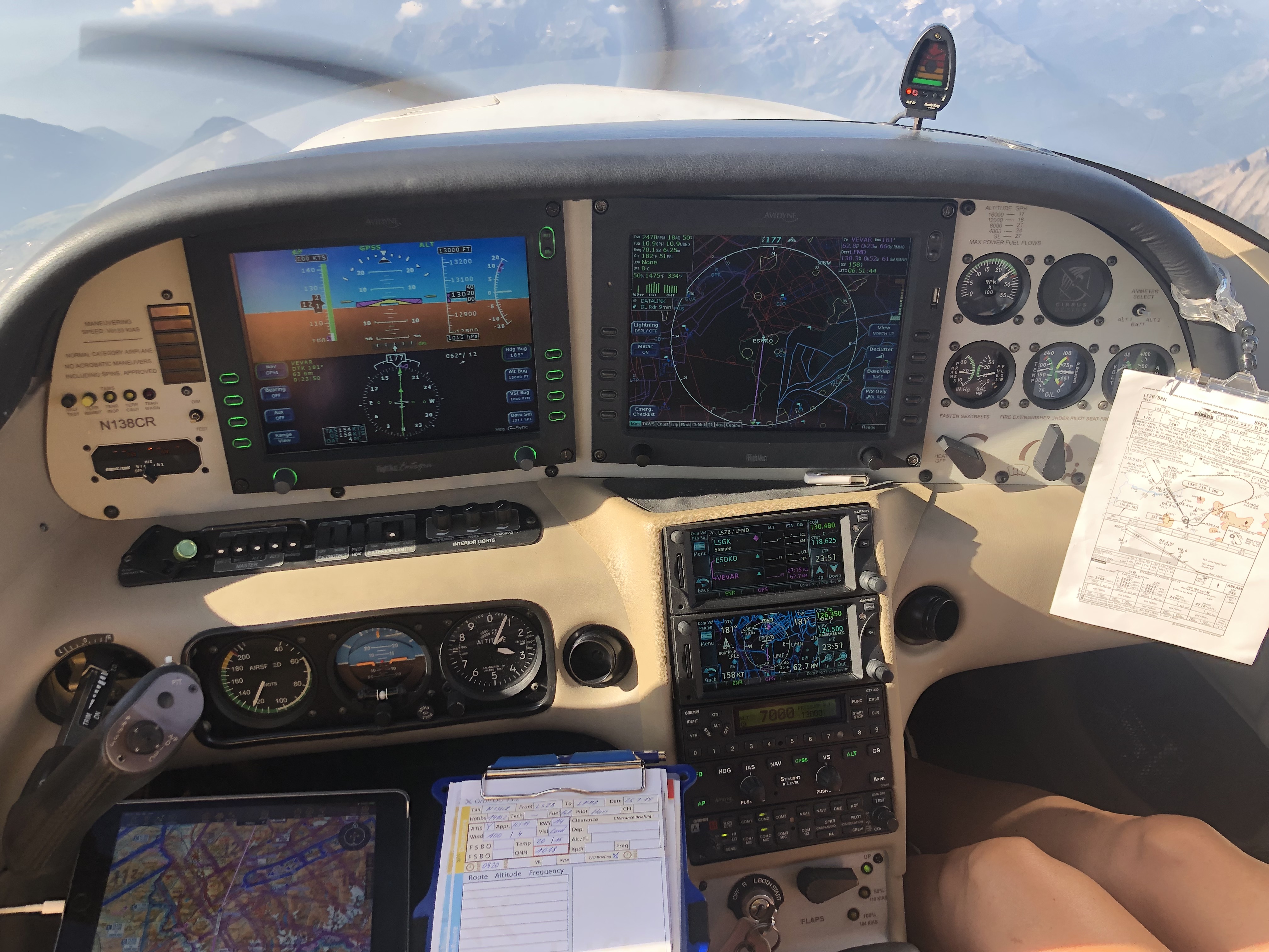
„George“ the autopilot is flying
Mountain peeks along the French – Italian border with the haze of the Po plane in the background
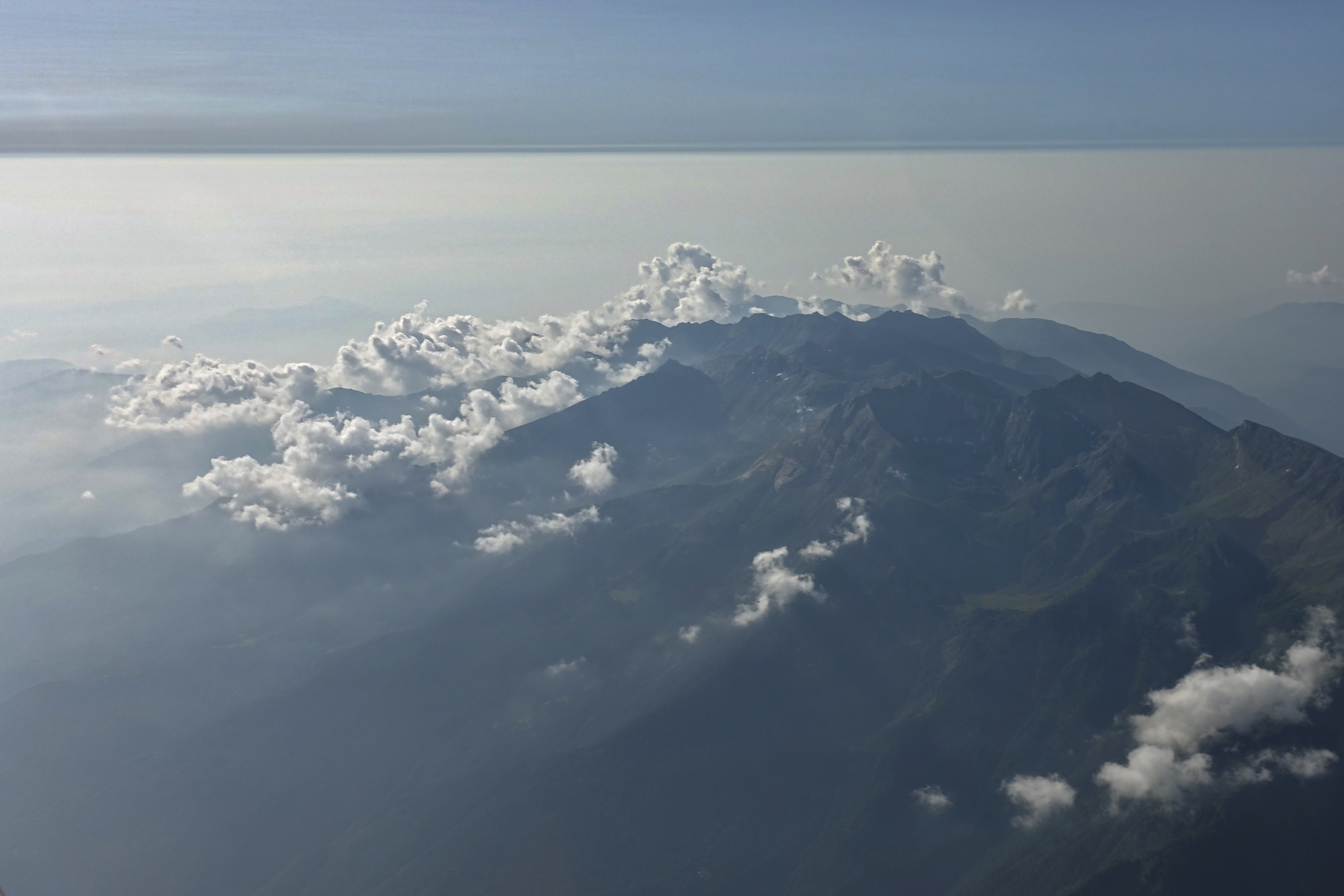
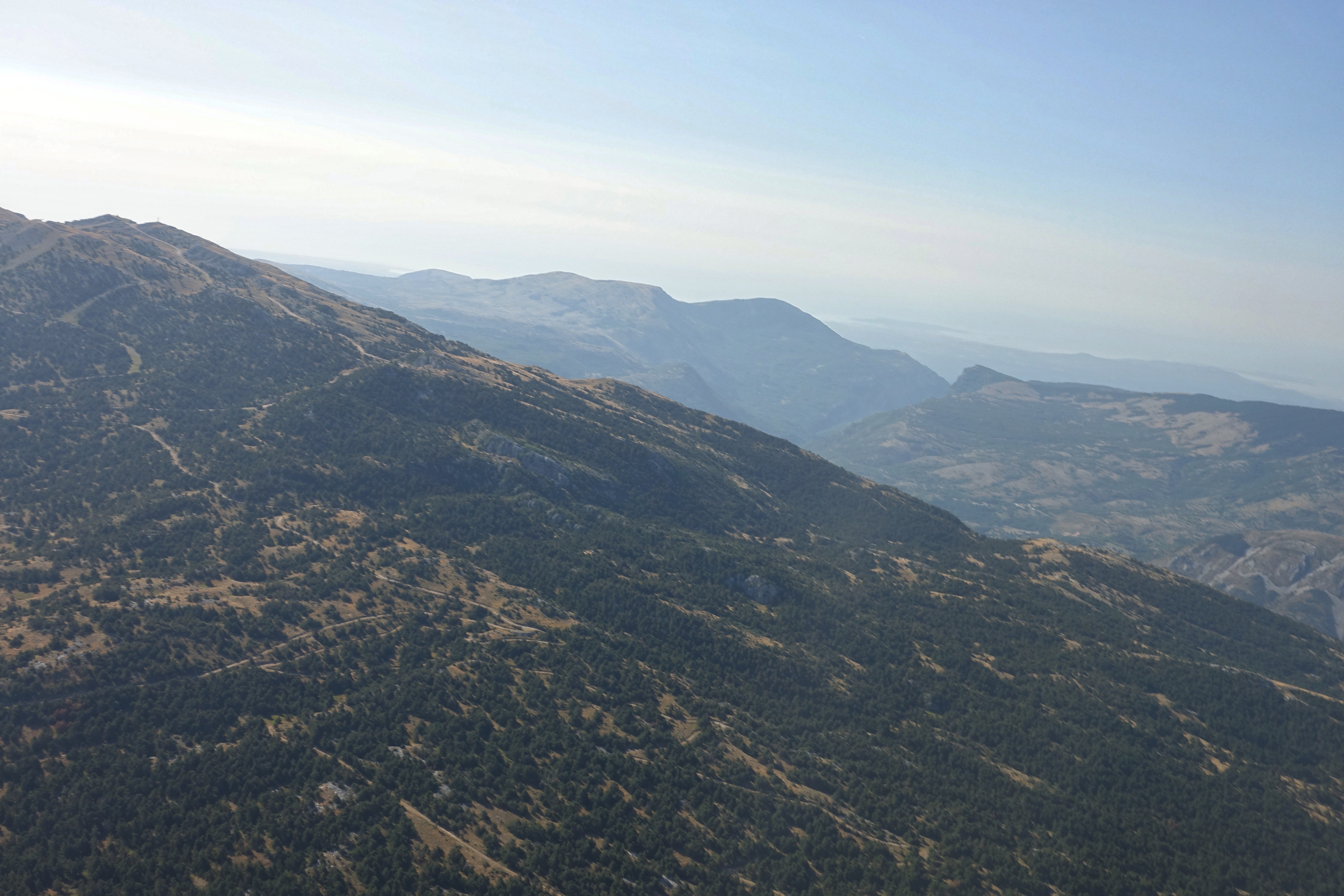
Italian Alps
It is exhausting to be in contact with Milano Information on this route. Milano always wants VFR waypoints with an EET. Unfortunately, the aeronautical charts in this lonely region hardly give waypoints. This then leads to a search on the map for a suitable Waypopint, a calculation of the EET for this point and the report to Milano Information. After a few minutes you will get the answer that they do not know where this point is because it is not on their map. So you are constantly busy with this and have to be careful not to forget to switch the fuel selector switch from time to time.
Abeam Monte Viso you should start your descent. Monte Viso or Monviso, is the highest mountain of the Cottian Alps. It is located in Italy close to the French border. Monte Viso is well known for its pyramid-like shape and, because it is higher than all its neighbouring peaks by about 500 m, it can be seen from great distance, including from the Piedmontese plateau, the Langhe, the Theodulpass in the Zermatt ski area and the summits of the Mont Blanc massif. On a very clear day it can be seen from the spires of the Milan Cathedral[citation needed]. It has been suggested that Monte Viso could be one of the mountains which inspired the Paramount logo. In Italy is also known as Il Re di Pietra (The Stone King) because of his prominence within western Italian Alps landscape. It has become UNESCO’s heritage as a cross-border biosphere reserve with France.
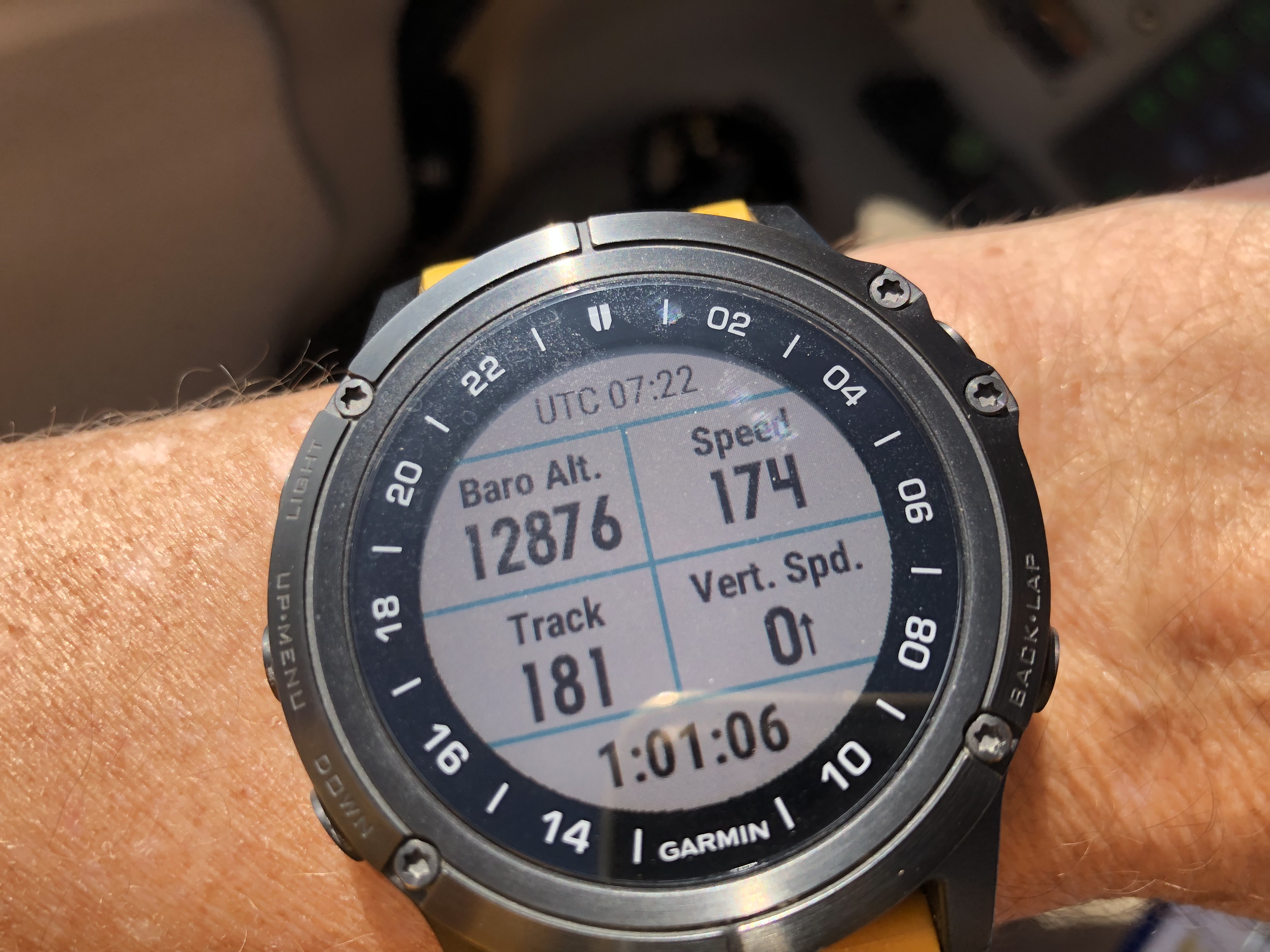
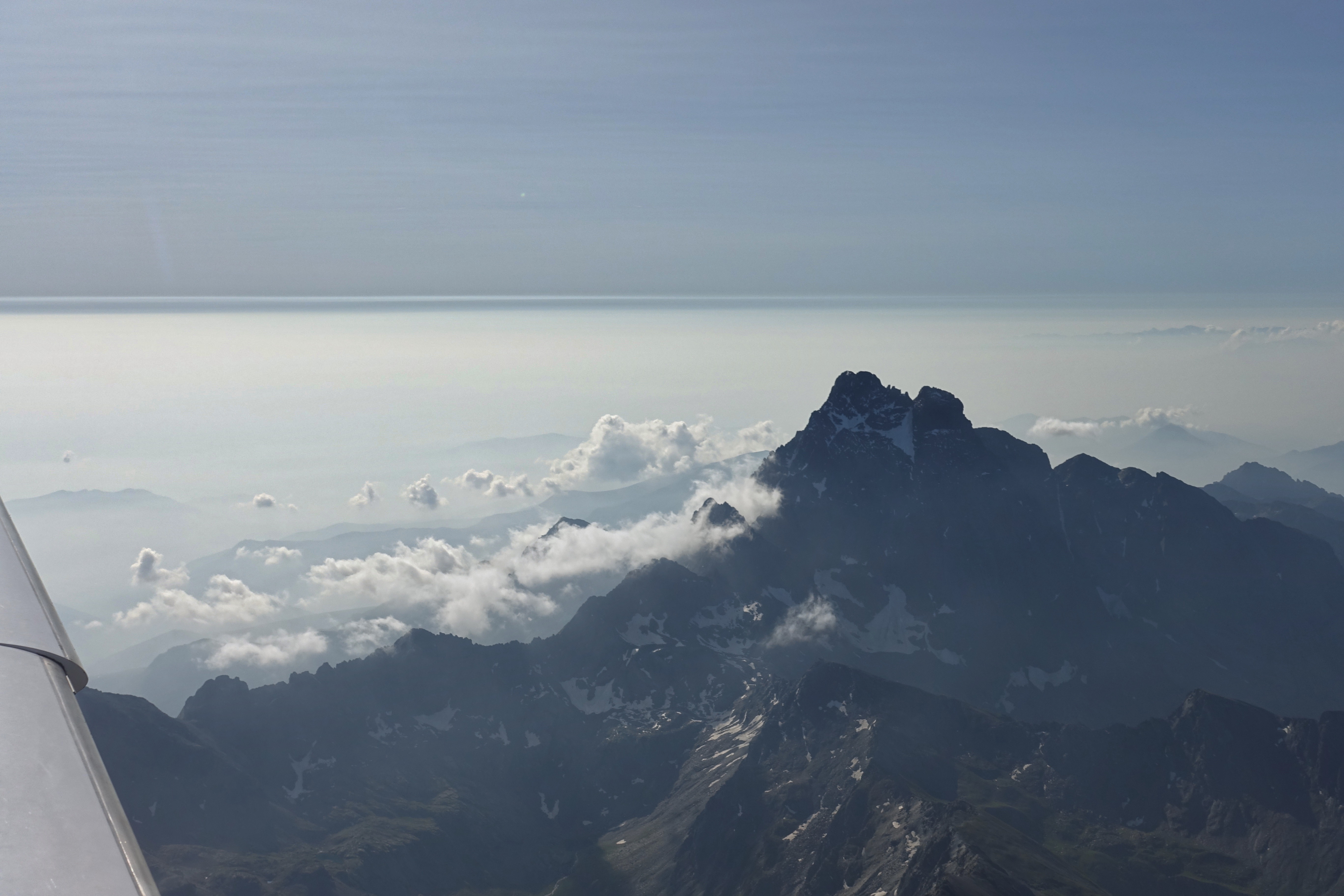
After 1h 01′ flight time…!
About 10 NM north of the Altisurface Valberg LF 0654 you should contact Nice Information. There you are usually already expected, get a squawk and a QNH and start the descent to get down to 3’000 ft at the entry point EW in Cannes.
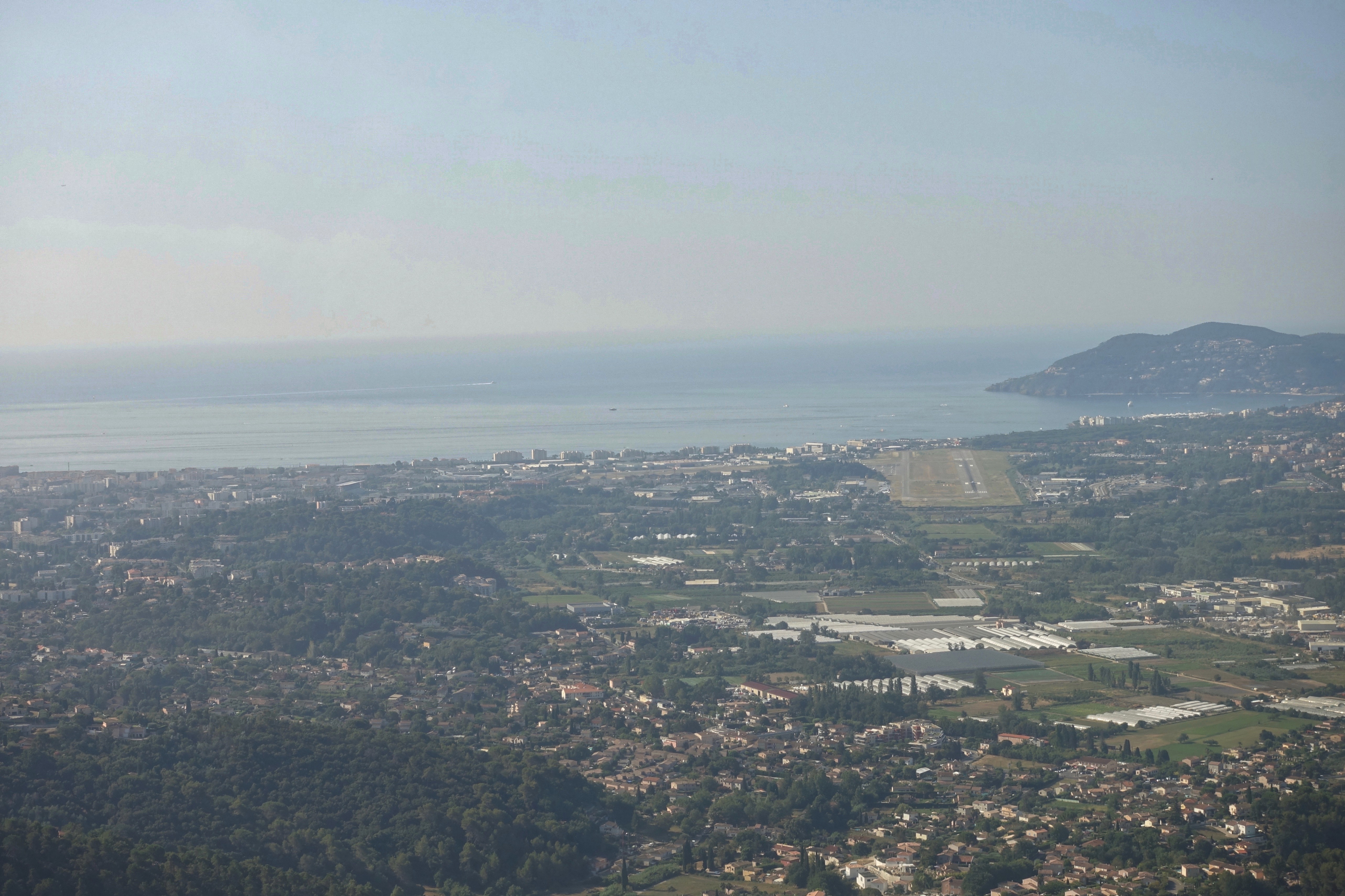
Since the last mountain range before the coast is about 6’000 ft high, a narrow valley (see picture above) east of the waypoint KOLON can be used to descend without problems. The entry point EW is a golf course NE of the airport Cannes. It is advisable to store this position in the GPS to avoid getting hectic. Nice information hands over to the pilots at EW at Cannes Tower and then one is already quite close to the airfield.
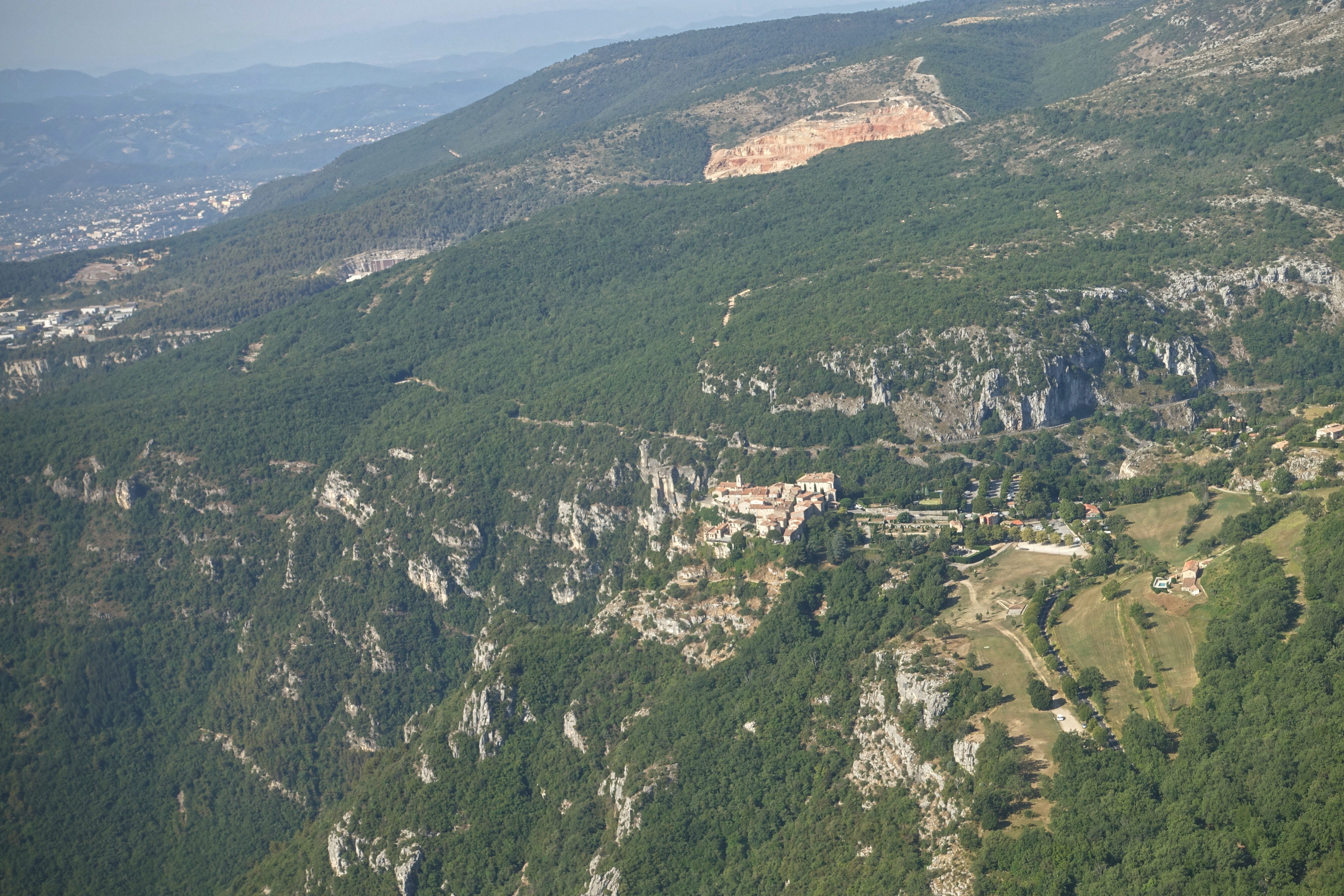 Gourdon is the archetype of a perched village, sitting like an eagle’s nest at the end of a rocky spur, enjoying a truly exceptional panoramic view over more than 80 kilometres of coastline from Theoule sur mer and Nice. It also forms a remarkably harmonious ensemble of white stone-built medieval houses, nestling around the feudal castle, all of which are beautifully restored and maintained.
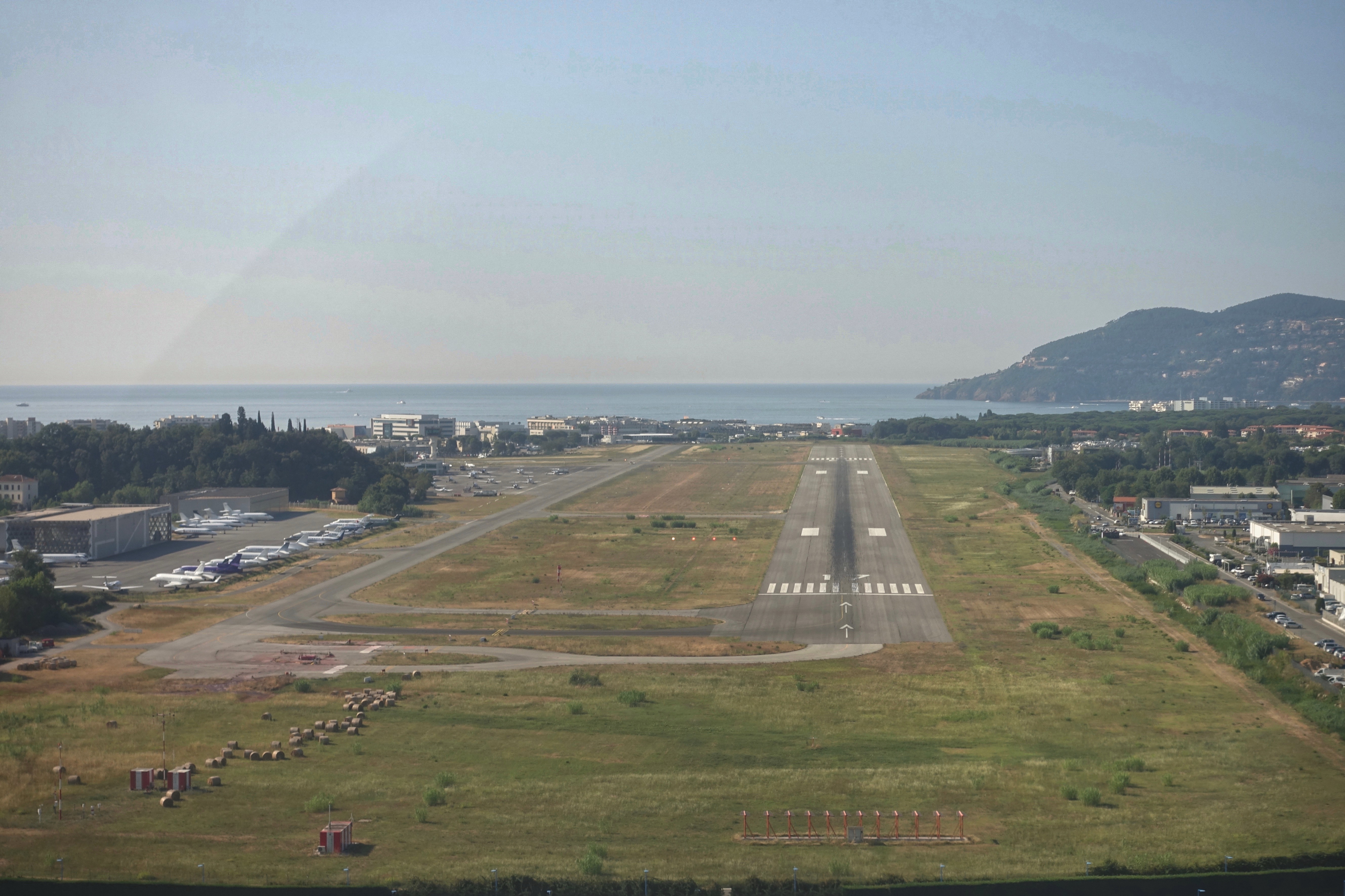
With the Cirrus this flight is usually possible in about 1h15′. Most of the time runway 17 is in operation and this offers enough length for a comfortable landing. If you leave the runway, Cannes Tower asks you to contact Cannes Ground. There you ask either to roll to the gas station or a parking space. Always tell them how long you would like to stay.
If you first want to refuel, there are two petrol pumps. Only the western one offers the possibility to pay with a normal credit card. For the petrol pump to the east you need a TOTAL card.
Cannes offers a great infrastructure and with EUROPCAR and HERTZ there are also two car rental providers. Taxis are also available to get to the nearby city.
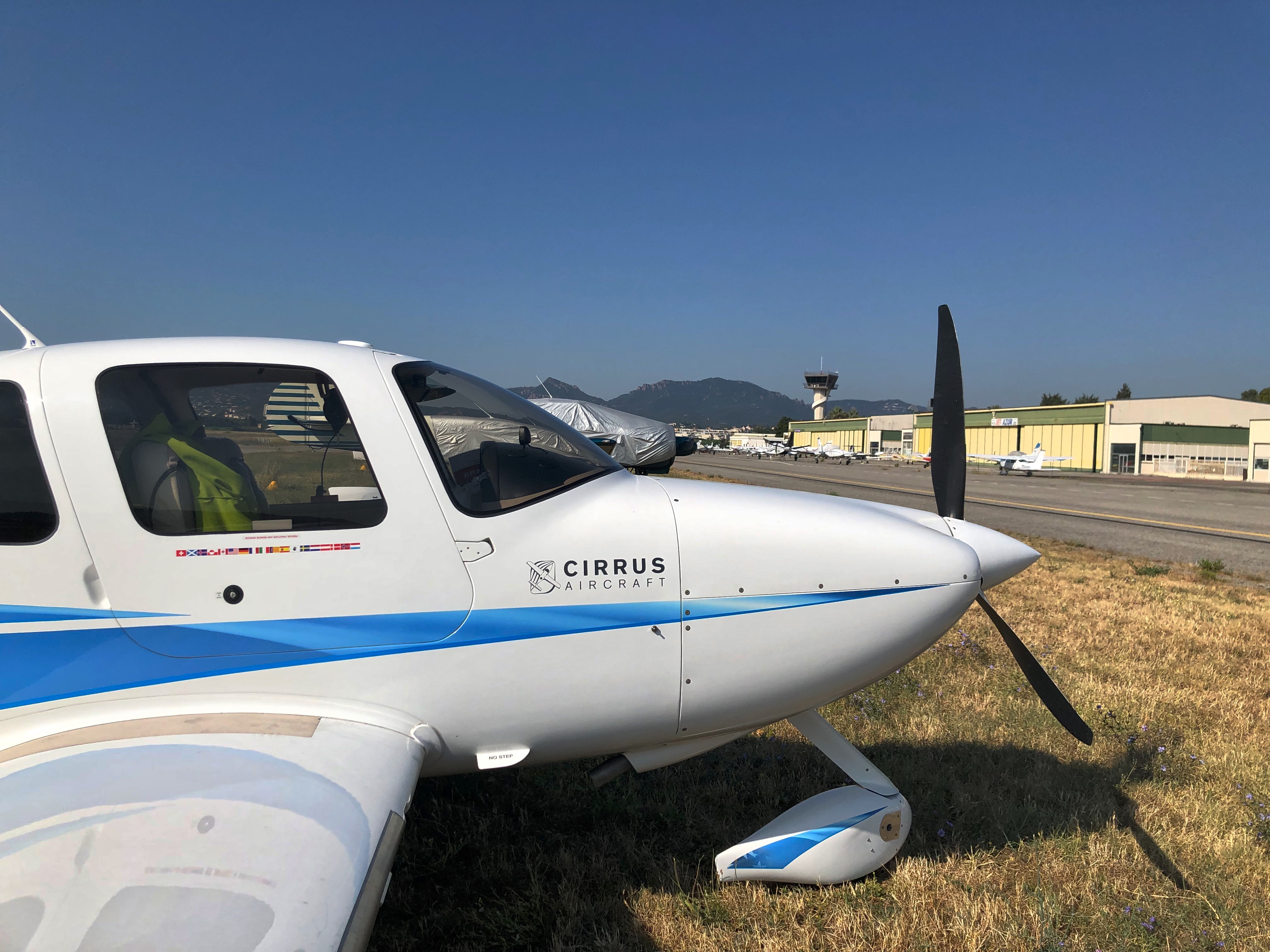
The single-engine aircraft of the visitors are given a parking space in the grass
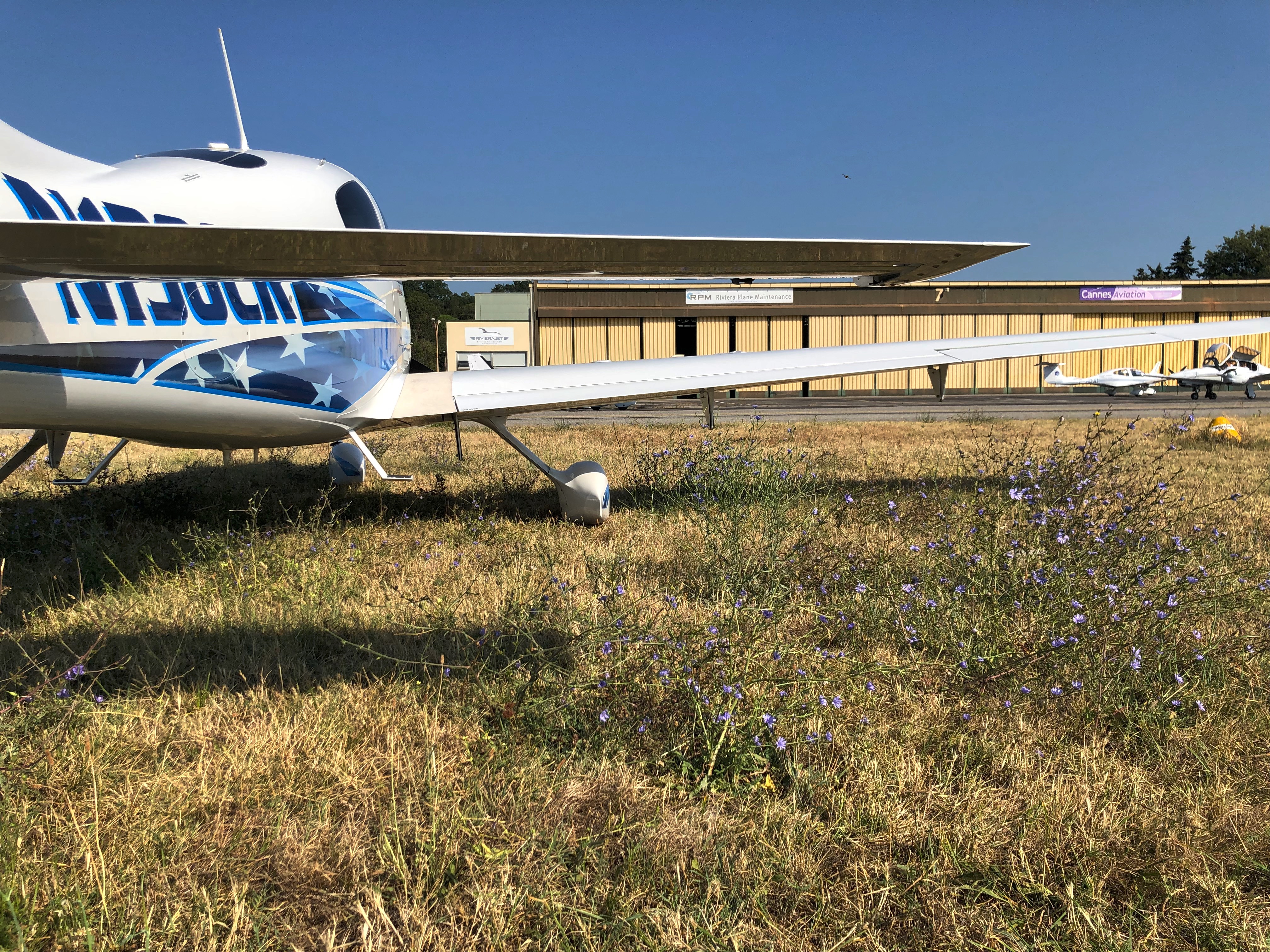 These grass parking areas are unfortunately in a poor condition with deep holes, high scrub and sometimes barely visible concrete blocks.
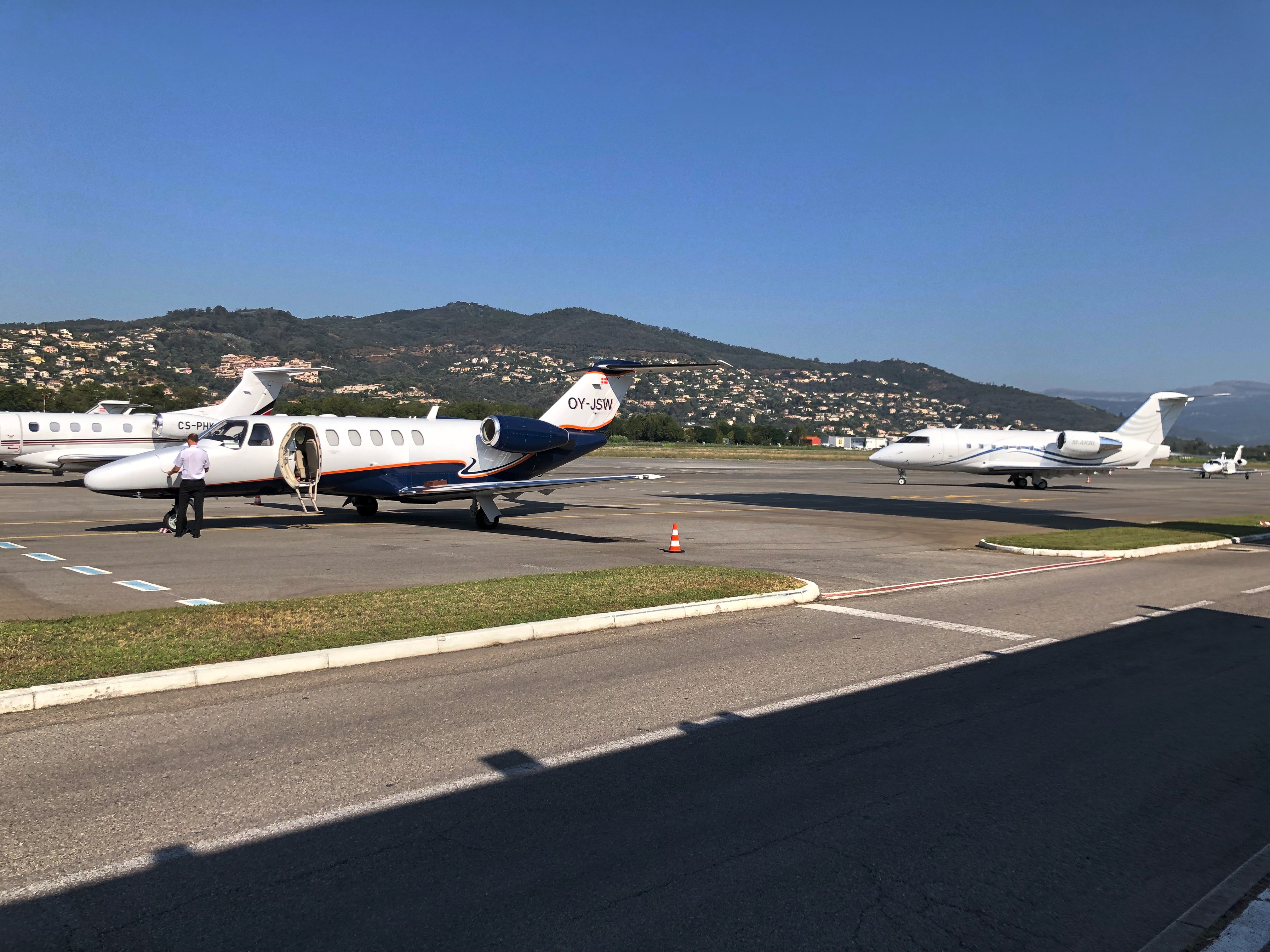
The Jets have a big apron
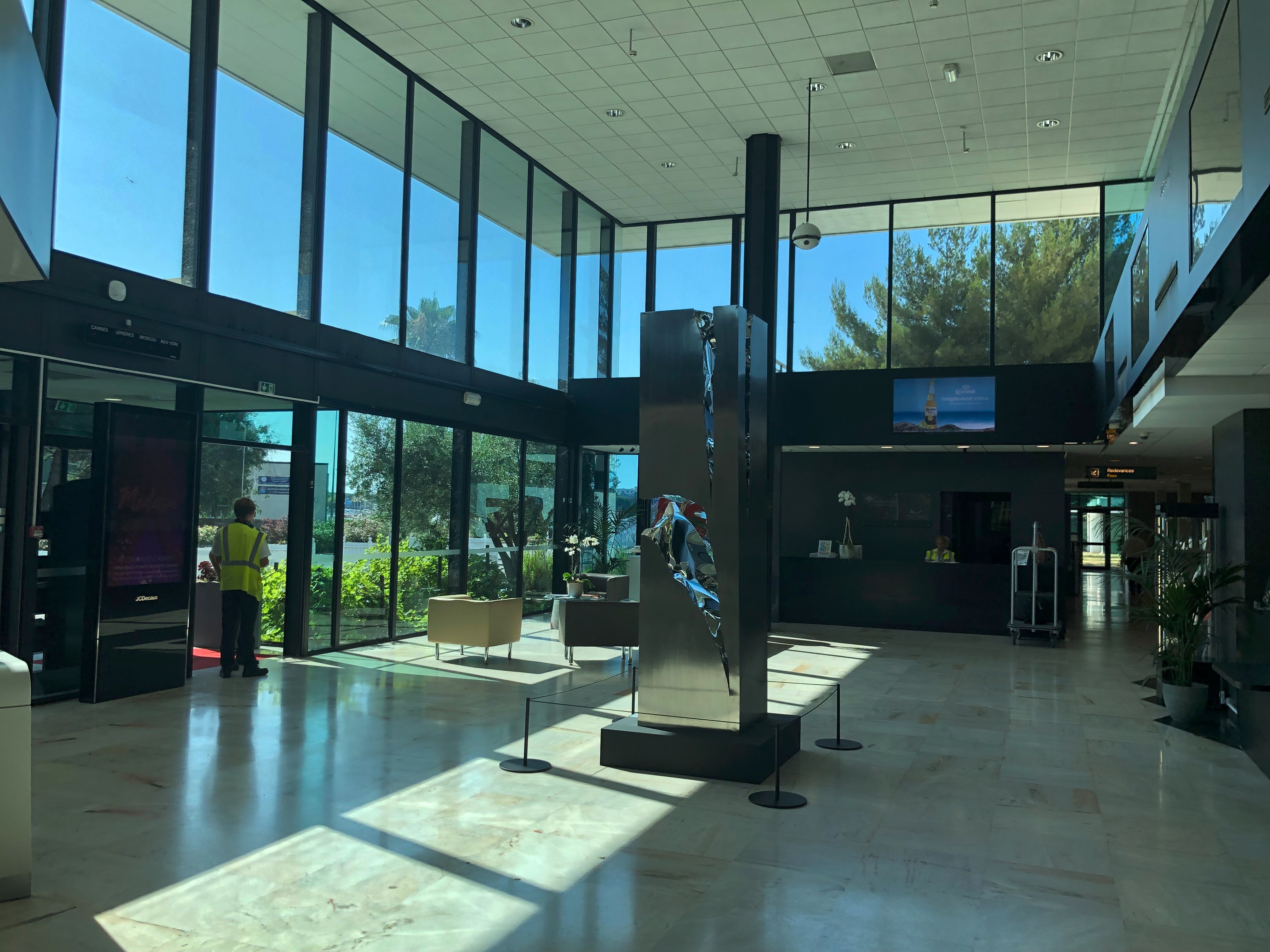
The big terminal building with a perfect service for business and general aviation

A mere two hours after takeoff you are at the beach…
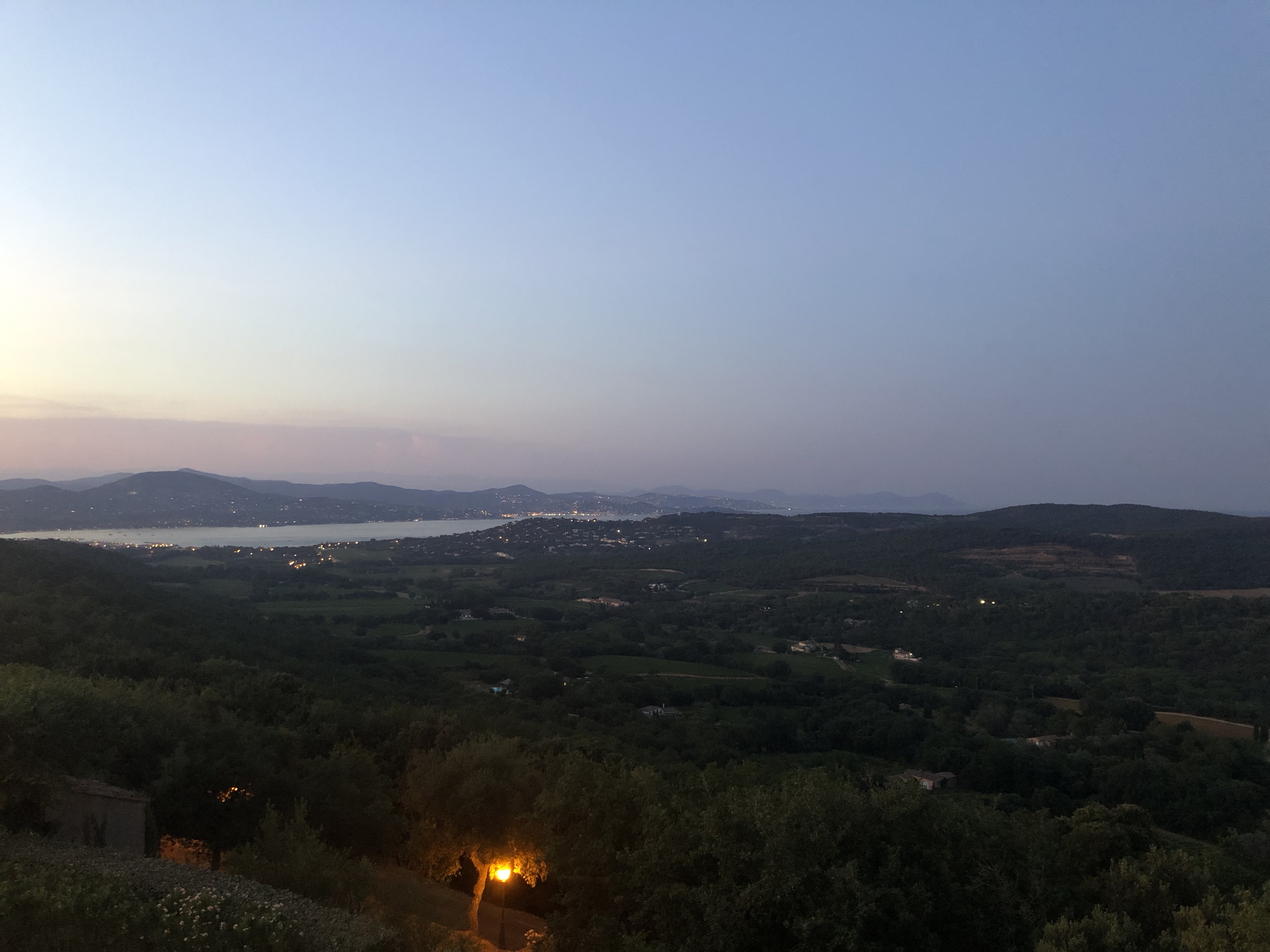
… and can spend a wonderful evening with delicious French food and wine.
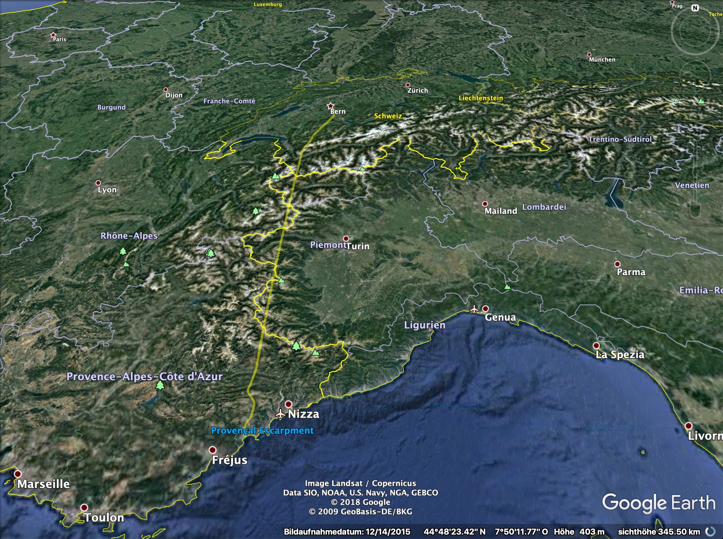
The track of the flight on Google maps.